Model Maps Response - city hospital
Model Maps Response - city hospital

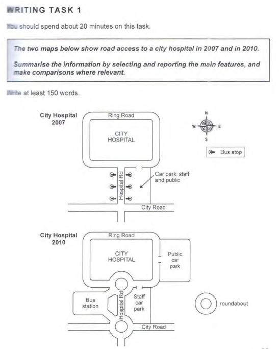
The twin maps show the routes leading to a city hospital in 2007 and three years later. Overall, the hospital was rectangular and situated on the north of the area. It was surrounded by the Ring road which is linked from the south by two other roads - the Hospital Road and the City Road. However, between both years, there were some transformations along these roads.
In 2007, the Hospital road was flanked on both sides by three bus-stops each. Also, to its right was a large car park, which was shared by the hospital’ staff and the general public. This park could as well be accessed through the Ring road from the North.
However, in 2010, a car park solely for the public was created to the right of the Ring road, while the old car park was designated solely to staff members. Also, the bus stops were totally removed and instead, two roundabouts were constructed north and south of the Hospital road to connect the road to the Ring Road on the north and the City Road on the south. In addition, a bus station was created on the west of the Hospital Road.
In conclusion, over the three year interval, a lot of infrastructural changes occurred particularly around the Hospital Road and the Ring Road leading to the hospital.
(211 words)
To stay updated on our latest blog posts, subscribe to our newsletter and follow us on social media platform. We look forward to embarking on this educational journey with you and creating a community of learners passionate about the power of education.


Comments (0)